Screenshots
Demo
The short movie demonstrates the capabilities of the LAPS project. While only one stand-alone camera is demonstrated, the software scales to a large network of cameras. Any number of cameras with an open API can harness the benfits of the LAPS project, from static and legacy PTZ cameras to smart cameras and mobile devices. The movie starts off adding a camera to the network using Plotter and then simulates the auto-focusing by clicking a point on a map in Console.
Camera Data Input Tool (Plotter)
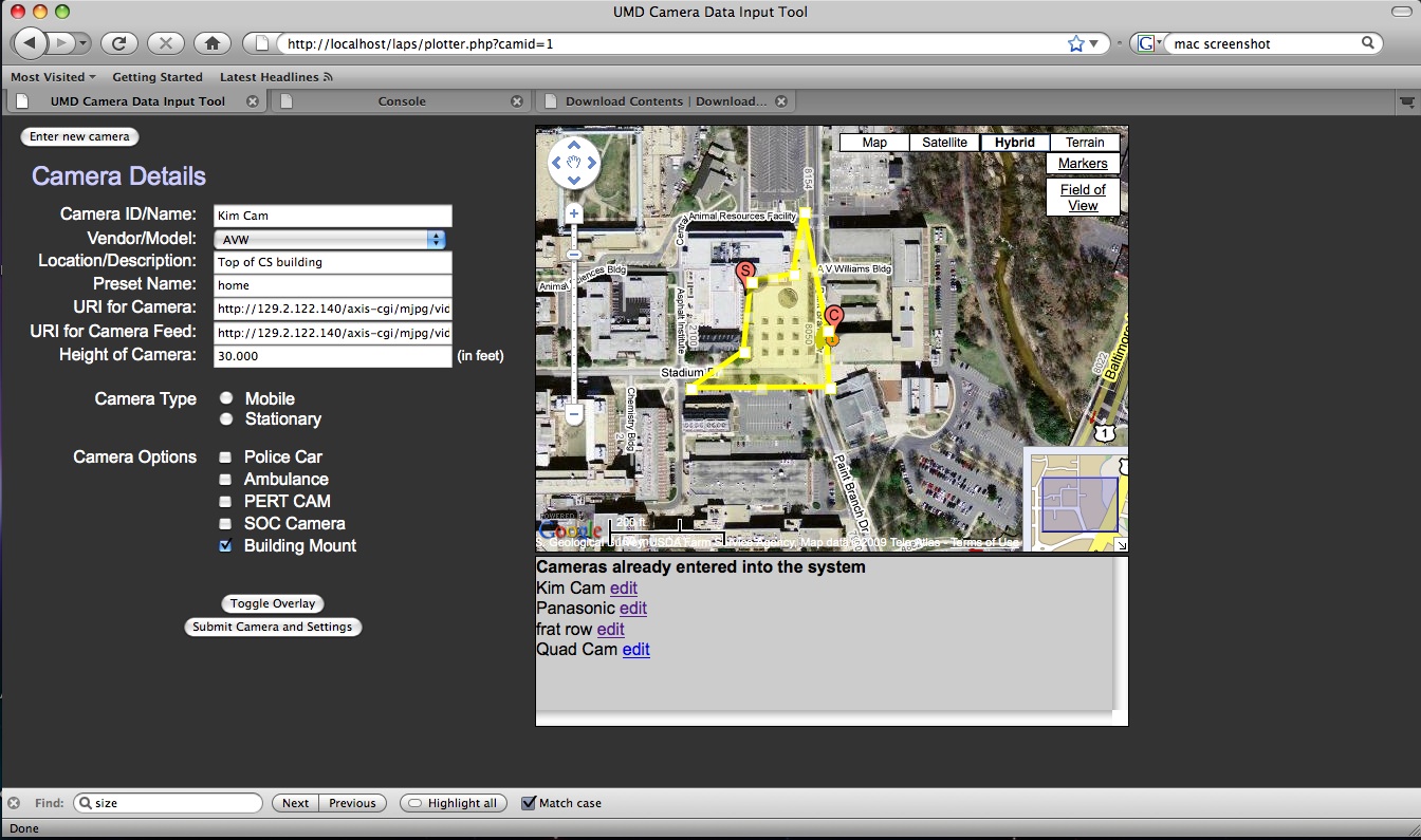
Data Input Tool allows users to use visual clues to accurately input cameras. Utilizing the Google Maps API, users enter data about each camera in the correct context. Markers and polygons easy to interact with and provide a simple user interface. Cameras details can easily be edited later if anything changes (for example: trees grow and coverage area shrinks).
Console
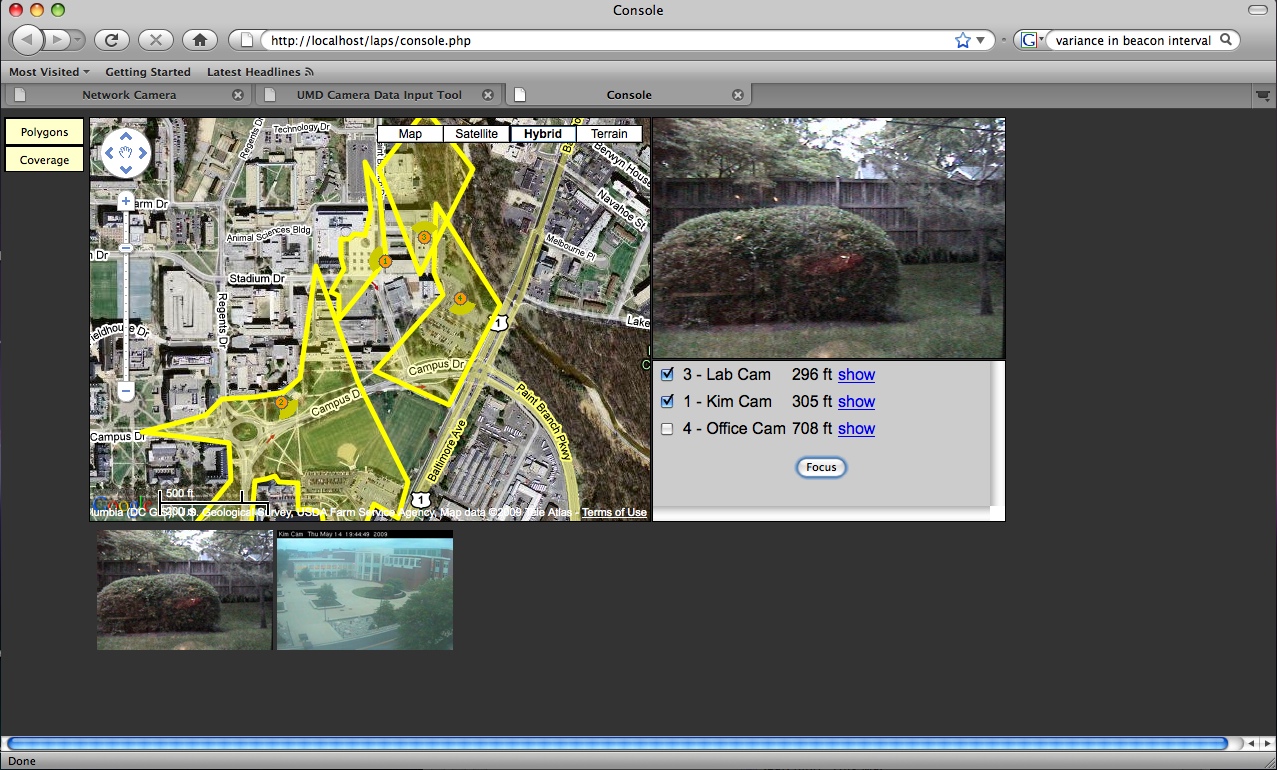
Console is provides an interface for operators to commit resources. Upon receiving an alert, a list of cameras that contain the incident in their coverage area are listed, based on distance in ascending order. Selecting cameras and clicking "Focus" automatically focuses PTZ cameras in the network towards the alert.