Implementation
Explanation
Plotter functions as a database entry tool. Users use visual clues to enter information about the cameras into the network. By providing a visual map API, such as Google Maps API, context is preserved and ensured without user knowledge. The camera, coverage area, home preset angle and textual information are stored in a backend database.
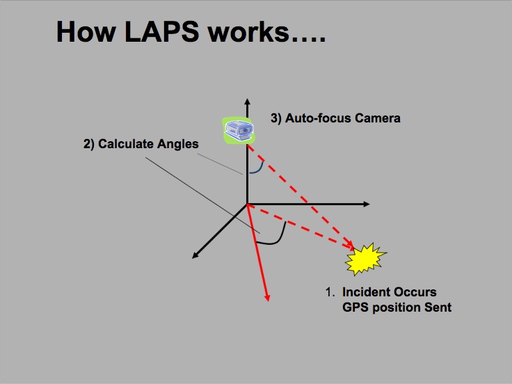 Console provides a visual overview of the network and an interface to interact with the cameras. Clicking on the map in the console application currently simulates receiving an alert from MyeVue or another emergency alert system. The system extracts the GPS point (latitude and longitude) and does one of two queries; a general distance query or a spatial query. Each query lists cameras in order of distance from the selected position. If a spatial query is performed, only cameras that have the point in their field of view are listed.
Users can allocate cameras to focus by selecting the appropriate check boxes. Clicking the "Focus" button causes the software to calculate the adjustments necessary for each camera. The software then builds a string of commands based for the specific camera model and sends these commands to the cameras, focusing the cameras on the incident.